HEC-HMS
Rainfall Time Series
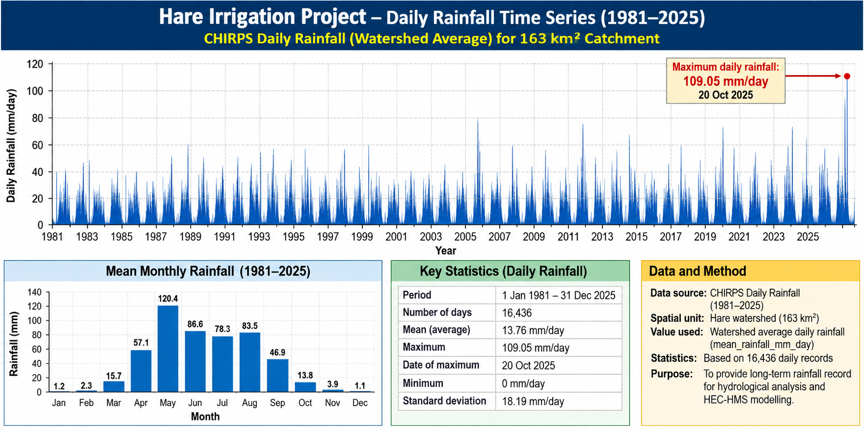
CHIRPS daily watershed-average rainfall time series for the Hare catchment, 1981-2025.
Technical figures produced during the modern reconstruction of the HARE Irrigation Project. The archive brings together HEC-HMS flood hydrology, SWAT watershed modelling, CROPWAT irrigation-demand analysis and HEC-RAS river hydraulics and floodplain modelling in one visual record.
CHIRPS daily watershed-average rainfall time series for the Hare catchment, 1981-2025.
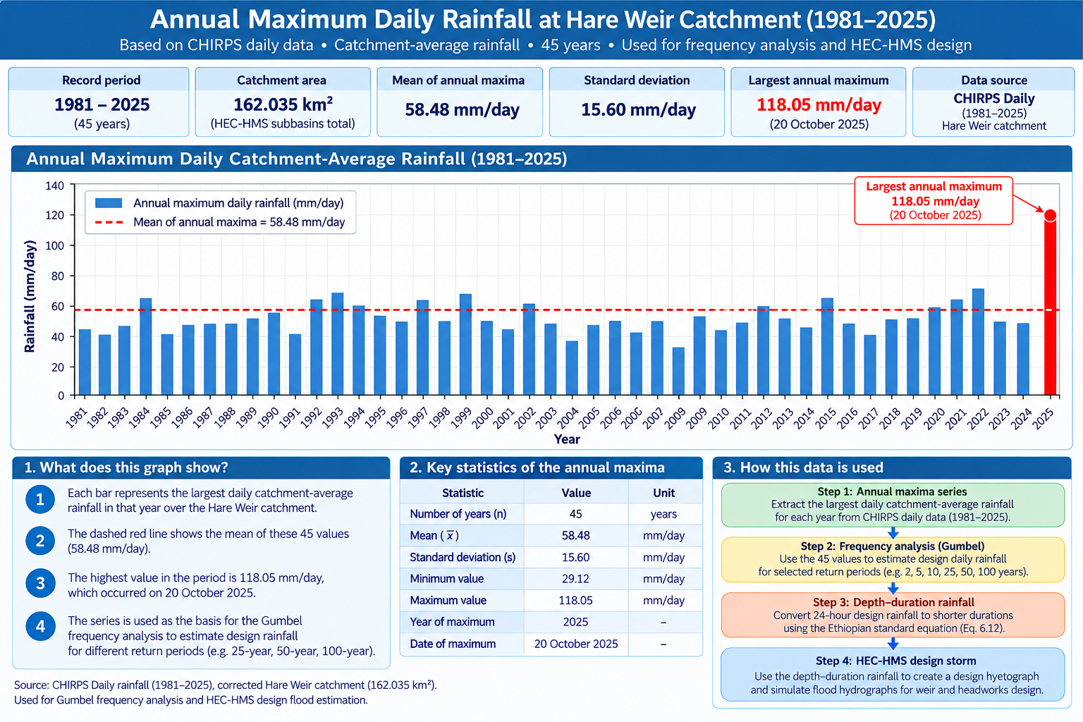
Annual maximum daily catchment-average rainfall series used for rainfall-frequency analysis.
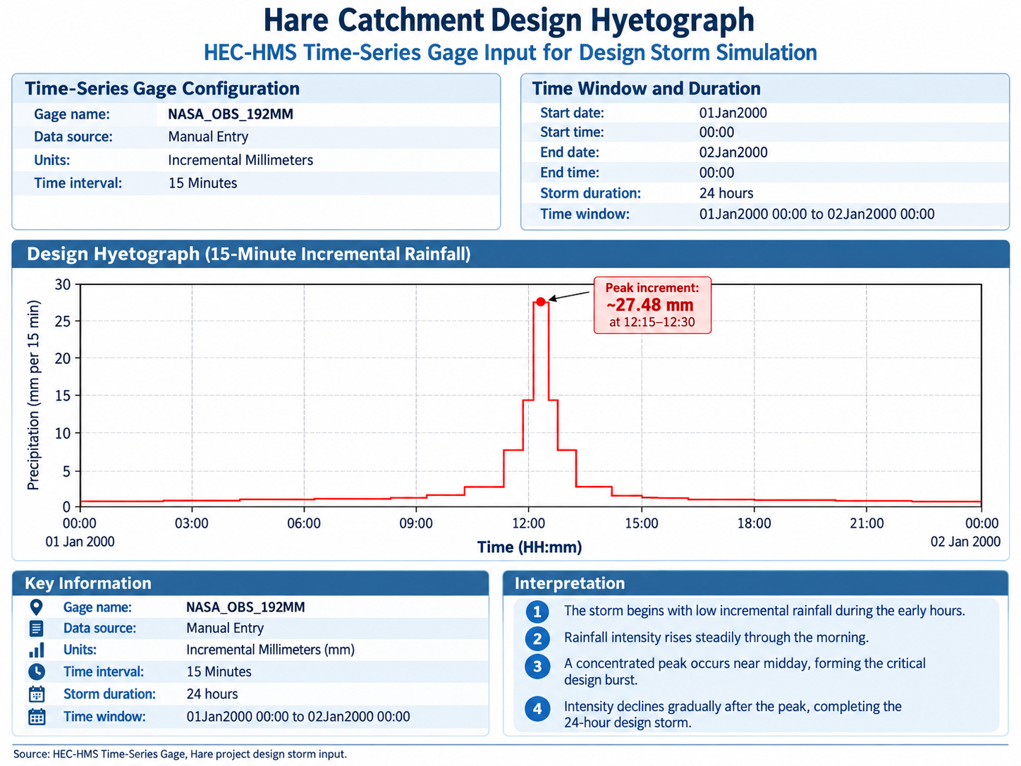
HEC-HMS 24-hour design storm represented as 15-minute incremental rainfall.
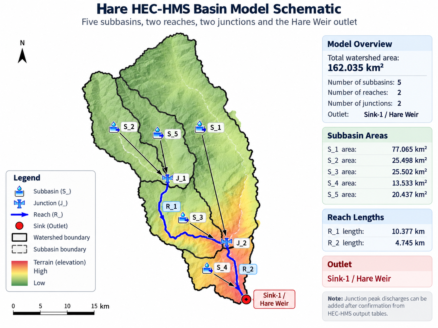
Schematic representation of the Hare HEC-HMS basin model and hydrological connectivity.

Comparison of HEC-HMS outlet hydrographs for the 25-year and 50-year design events.
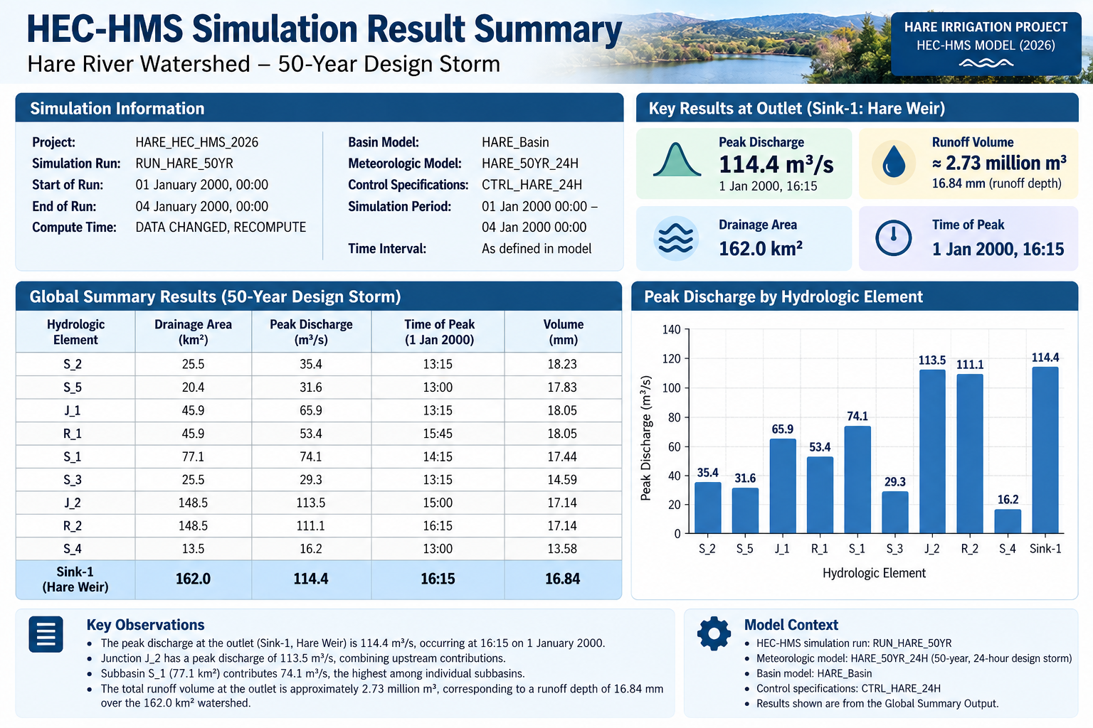
Technical summary of the 50-year HEC-HMS simulation and design-flood results.

Detailed outlet flood hydrograph for the 50-year HEC-HMS design event.
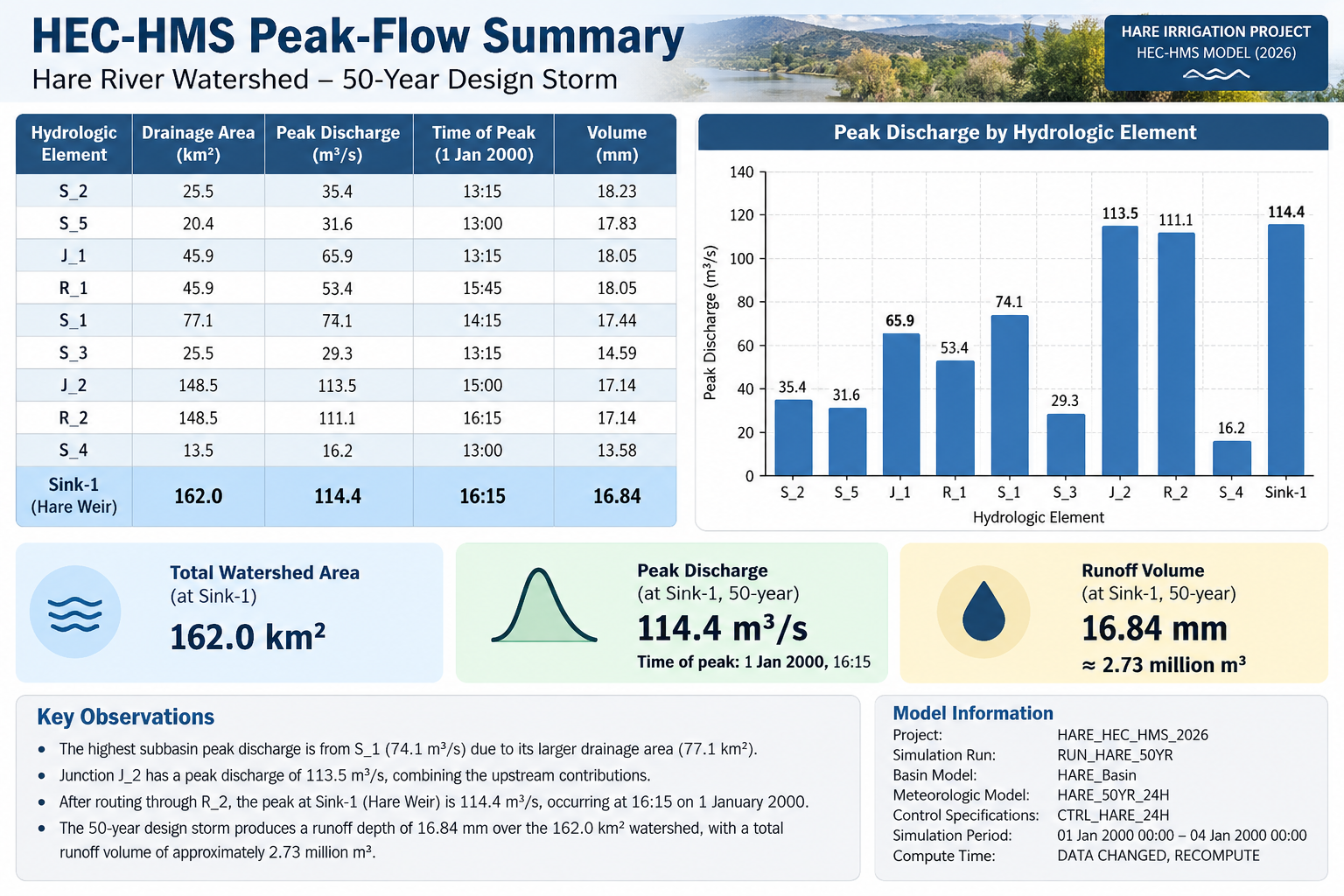
Summary of modelled peak flow and key HEC-HMS flood-design values.

HEC-HMS 50-year runoff depth and flood-volume summary for the Hare catchment.

Contribution of individual subbasins and routed flow within the 50-year HEC-HMS simulation.
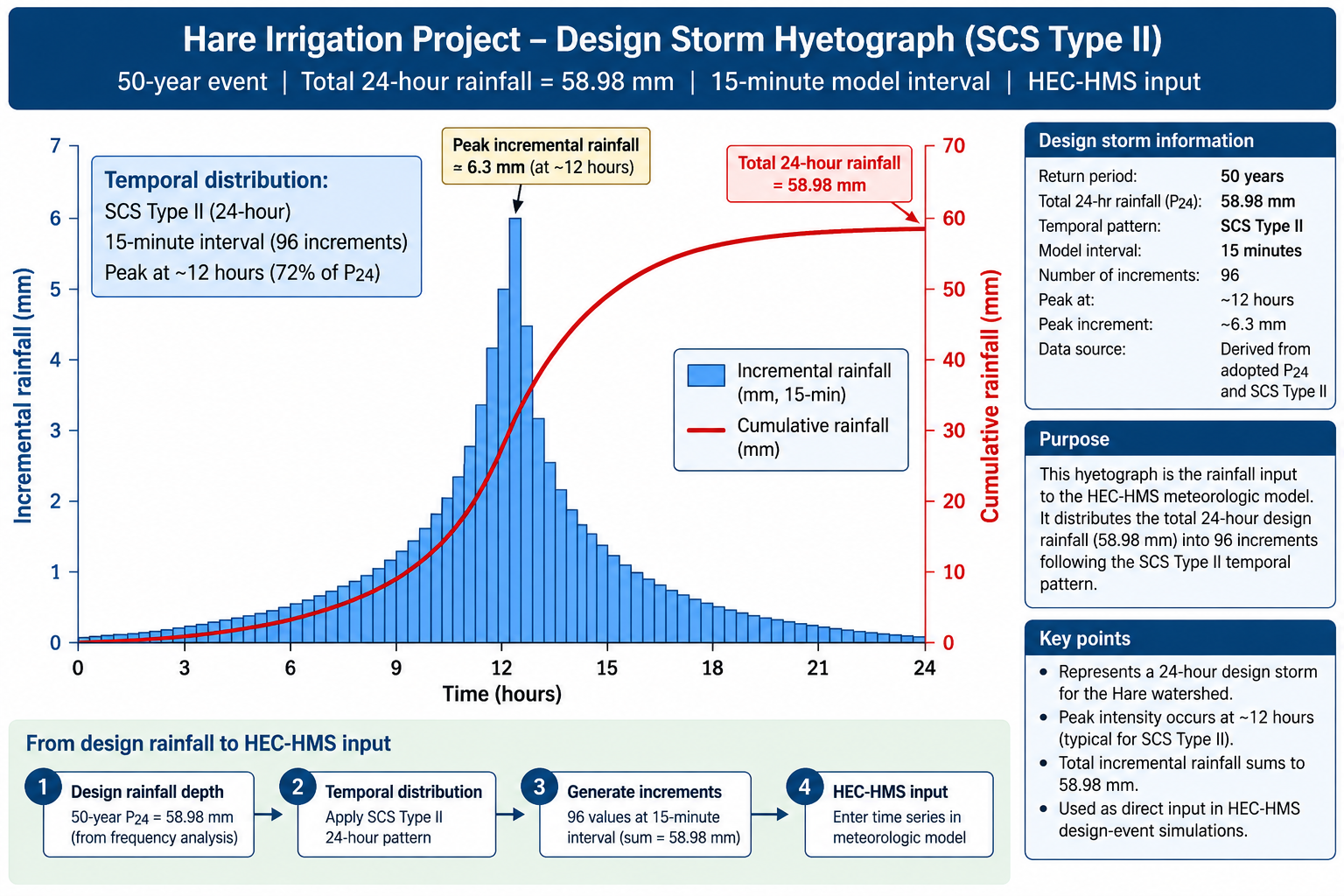
SCS Type II design-storm hyetograph used for the 50-year HEC-HMS simulation.
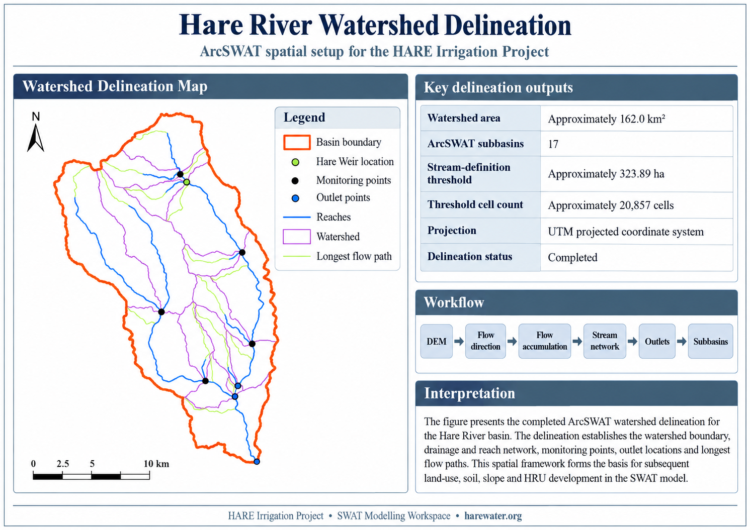
DEM-derived Hare watershed, drainage network and outlet configuration prepared for the SWAT model.
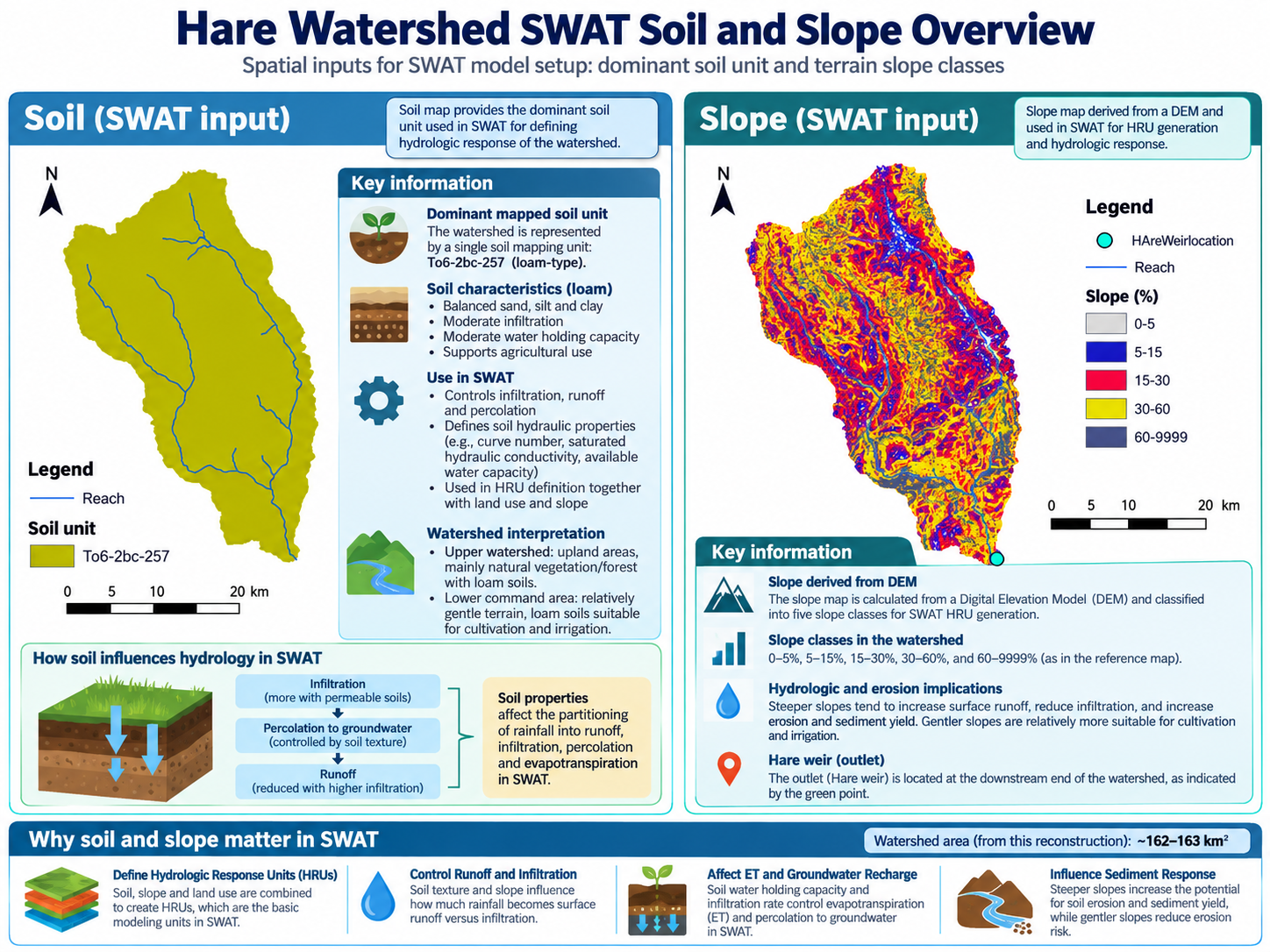
Combined infographic of the actual SWAT soil input and DEM-derived slope classes used for watershed and HRU analysis.
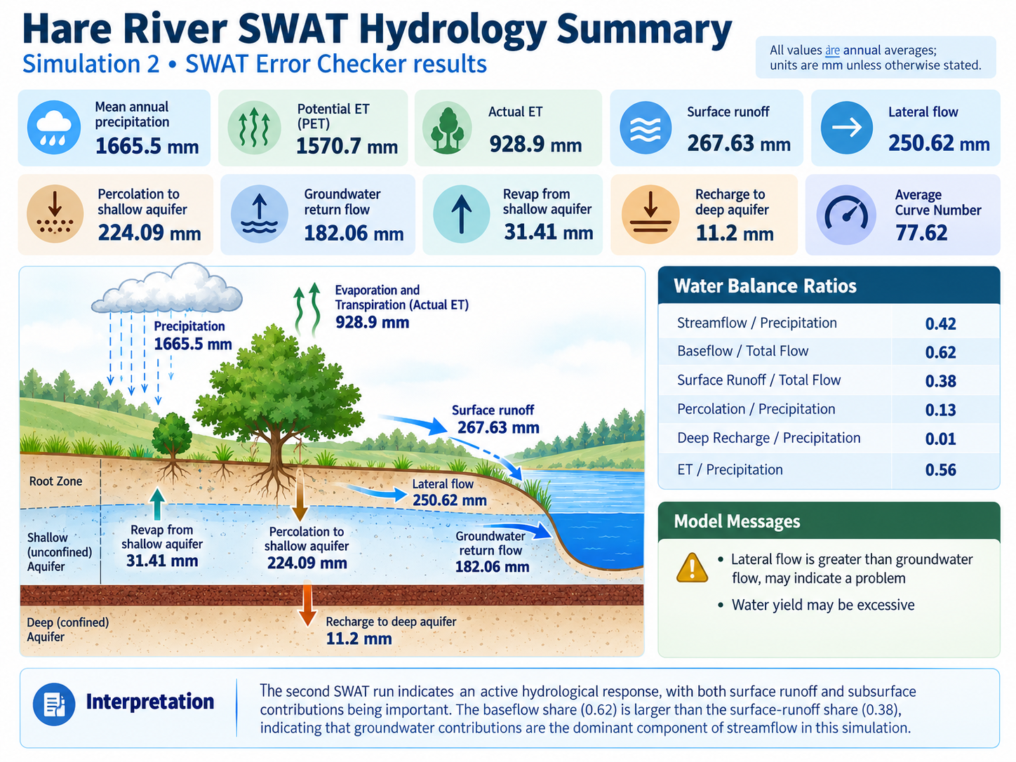
Simulation water-balance summary including precipitation, PET, evapotranspiration, surface runoff, lateral flow and groundwater return flow.
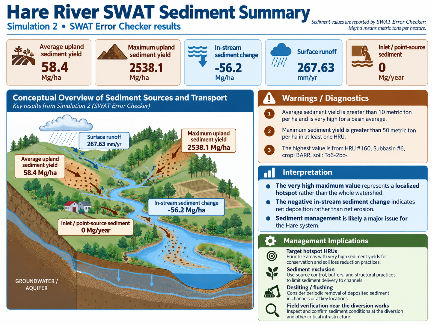
Summary of simulated sediment generation, transport and watershed sediment response from the SWAT reconstruction.

Project-focused interpretation of SWAT sediment results at the Hare diversion weir and their relevance to operation and maintenance.
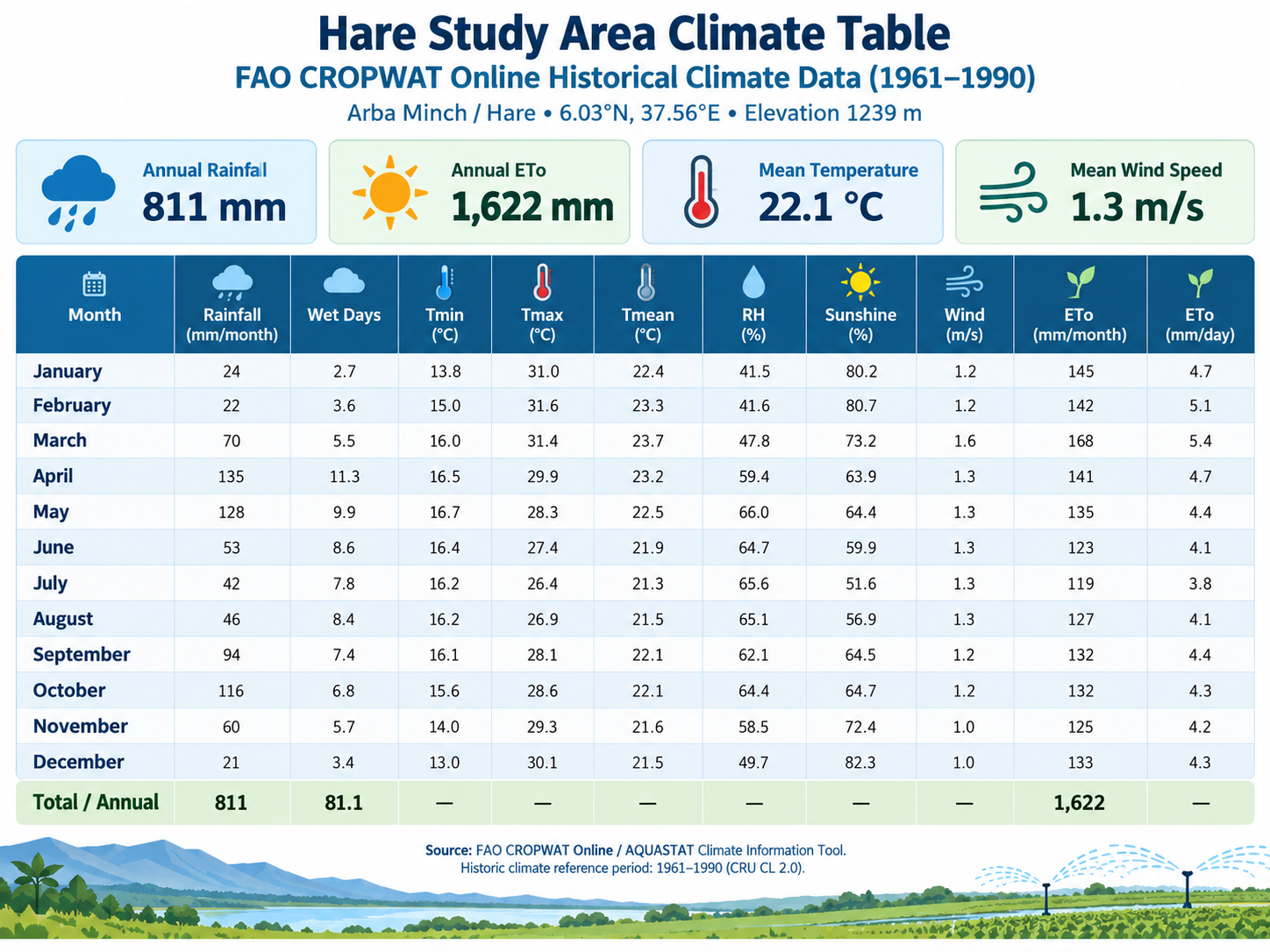
FAO historical climate data used for reference evapotranspiration and crop-water analysis.
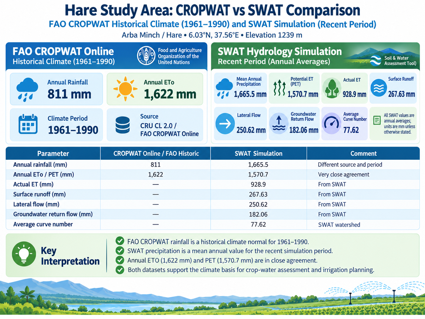
Comparison of rainfall and evapotranspiration indicators between CROPWAT climate data and SWAT.
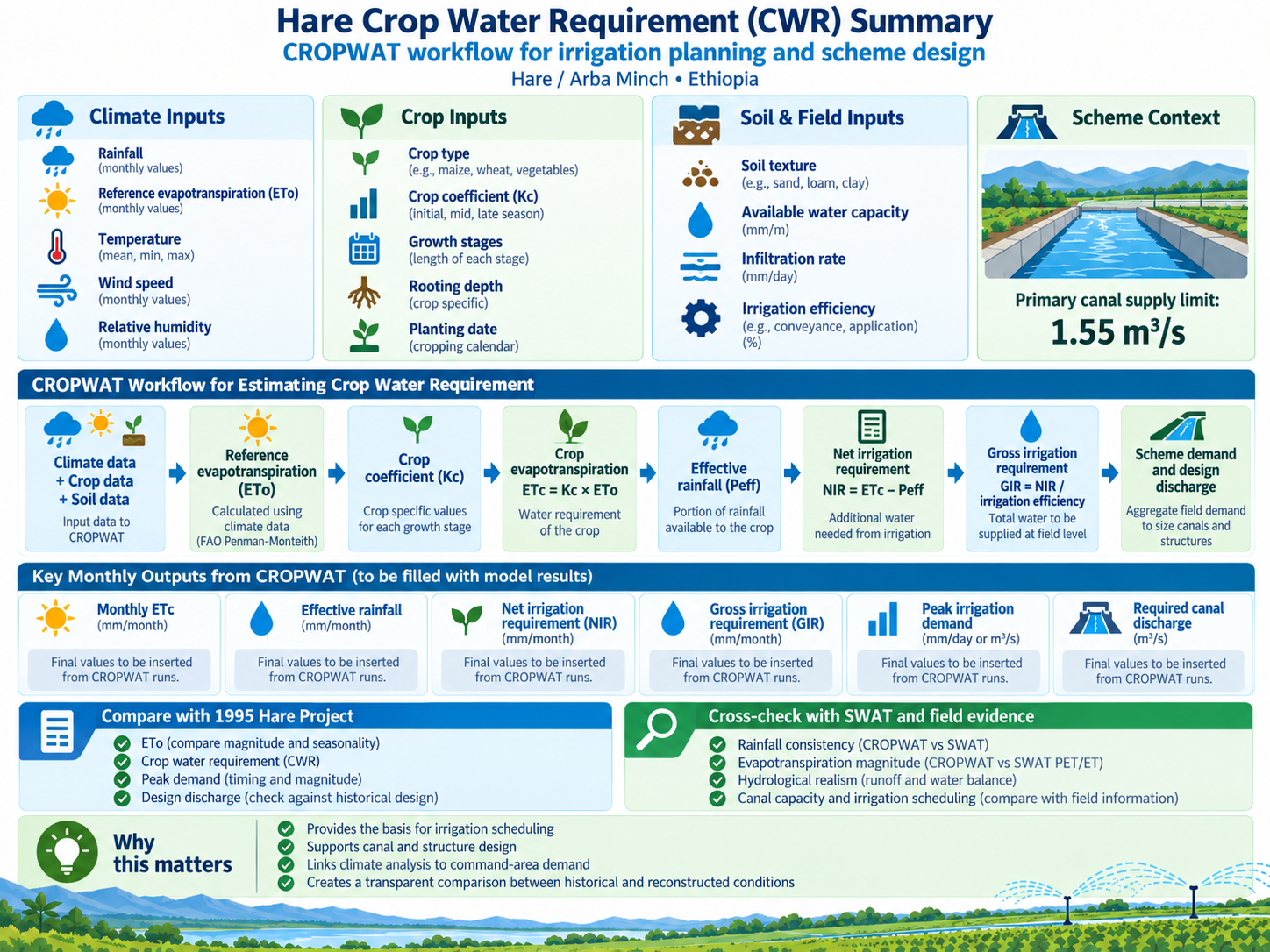
Summary of crop-water-requirement methodology and irrigation-demand workflow.

Land-cover interpretation and hydraulic roughness used across the HEC-RAS 2D computational domain.

Development of the 50-year synthetic design rainfall used in the HARE hydrological and hydraulic modelling workflow.
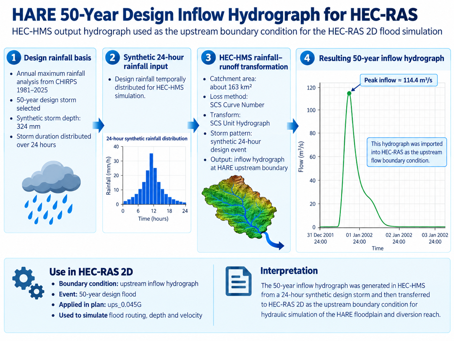
HEC-HMS 50-year runoff hydrograph transferred to HEC-RAS as the principal upstream hydraulic boundary condition.
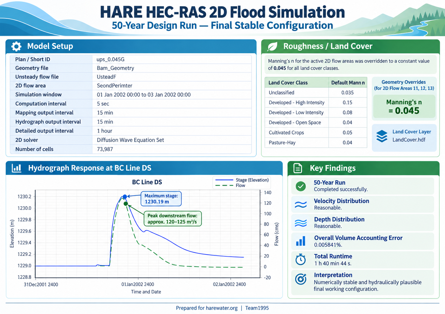
Final HEC-RAS 2D simulation summary for plan ups_0.045G, including model configuration, hydraulic response and numerical performance.
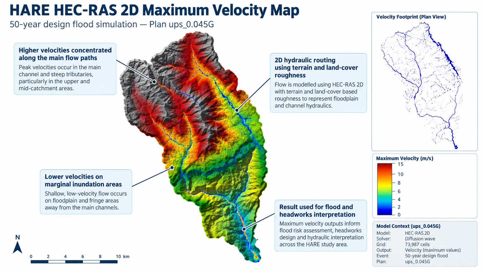
Maximum simulated velocity distribution for the 50-year event, showing the principal high-energy river and tributary flow paths.
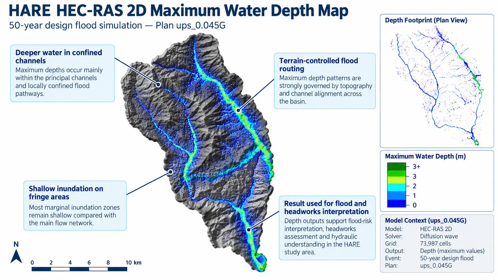
Maximum simulated water-depth distribution for the 50-year event across the HARE 2D hydraulic domain.
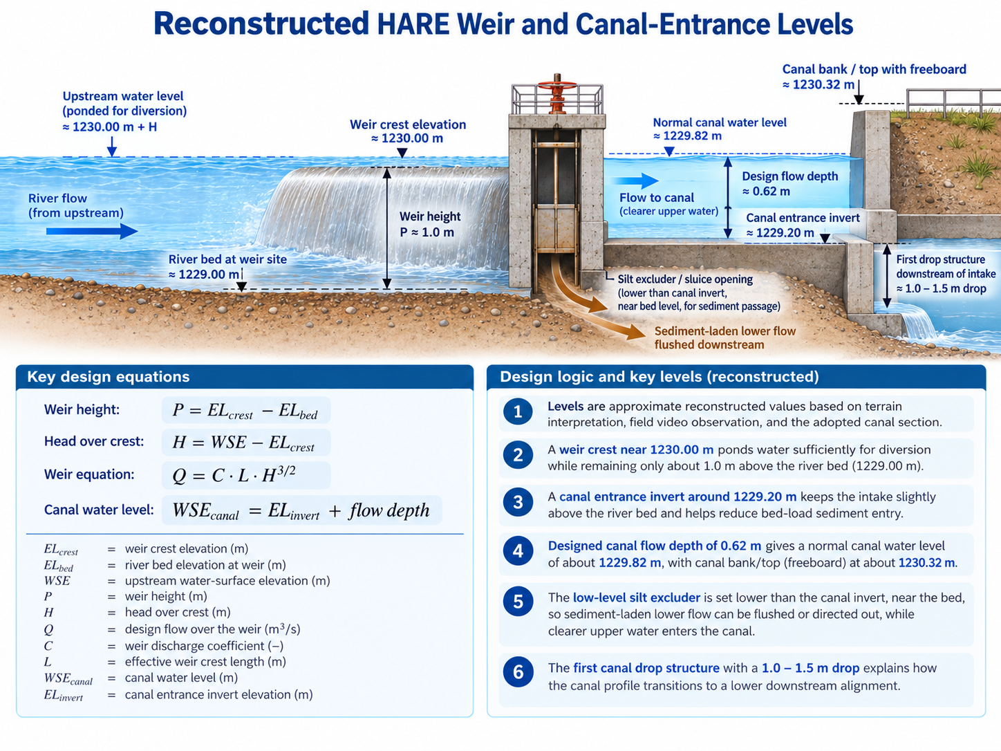
Approximate reconstruction of the HARE diversion headworks showing river-bed level, weir crest, canal entrance, normal canal water level, low-level sediment excluder and downstream canal drop.